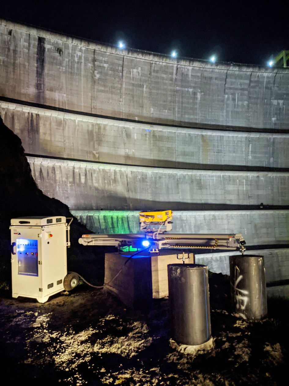
The goal of the Local Deformation Monitoring is to use microwave remote sensing techniques to measure and calculate the deformation of the dam. Our measurement instrument is a Ground-based Synthetic Aperture Radar (GB-SAR). Contrary to classical geodetic system as total stations, levelling or GNSS, the GB-SAR provides 2D complex images and not pointwise measurement. By exploiting the phase of the received signal, it is possible to obtain a map of the displacement of the dam between two acquisitions with an accuracy up to 1 mm. The temporal resolution of the system is one acquisition every two minutes and enables a real time monitoring. For each point on the GB-SAR image, the observed displacement by the radar is only determined in one dimension, the Line-Of-Sight (LOS), which mean in the direction linking the point itself and the radar.
The GB-SAR system will be used in two different ways. The first one is a continuous long-term monitoring, where the GB-SAR will be placed at a fixed standpoint called Warehouse for one year. This continuous monitoring enables to see the influence of the large fluctuation of the water level at the reservoir, which can be up to 100m in a cycle.
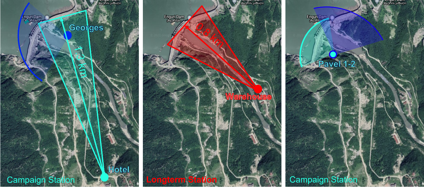
Figure 1: Position of the GB-SAR stations
The GB-SAR is also used to lead campaign measurement. Every 3 to 5 months, we move the GB-SAR at four different stations, to observe the dam from other locations for 1 to 2 days. From those standpoints we do not have a real time monitoring, but we can estimate the displacement of the dam between two campaigns. We have several one-dimensional displacement Information that we can use to recover the full 3D displacement. From the station Georges we have a perfect view from the bottom of the left side of the dam. From station Pavel-1 and 2 we have a view from the top of the right side of the dam. Station Hotel is installed because it is nearby a GNSS antenna and Corner reflectors from the GIK institute.
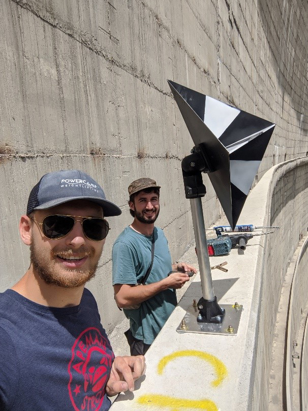
During our campaign measurement in July we installed Corner Reflectors on the dam to have points on the radar image which have a more stable signal. They are also useful to fuse our different station measurements, as they are clearly recognizable on the GB-SAR image. The corner reflectors were also painted with a black and white template pointing the phase center of the reflector. Therefore, we can extract its 3D coordinates via photogrammetric techniques.
| First Installation of the GB-SAR at Warehouse | 21 April 2021 |
| First Campaign | 17.06.2021 to 07.07.2021 |
| Second Campaign | 27.09.2021 to 07.10.2021 |
| Third Campaign | April 2022 |
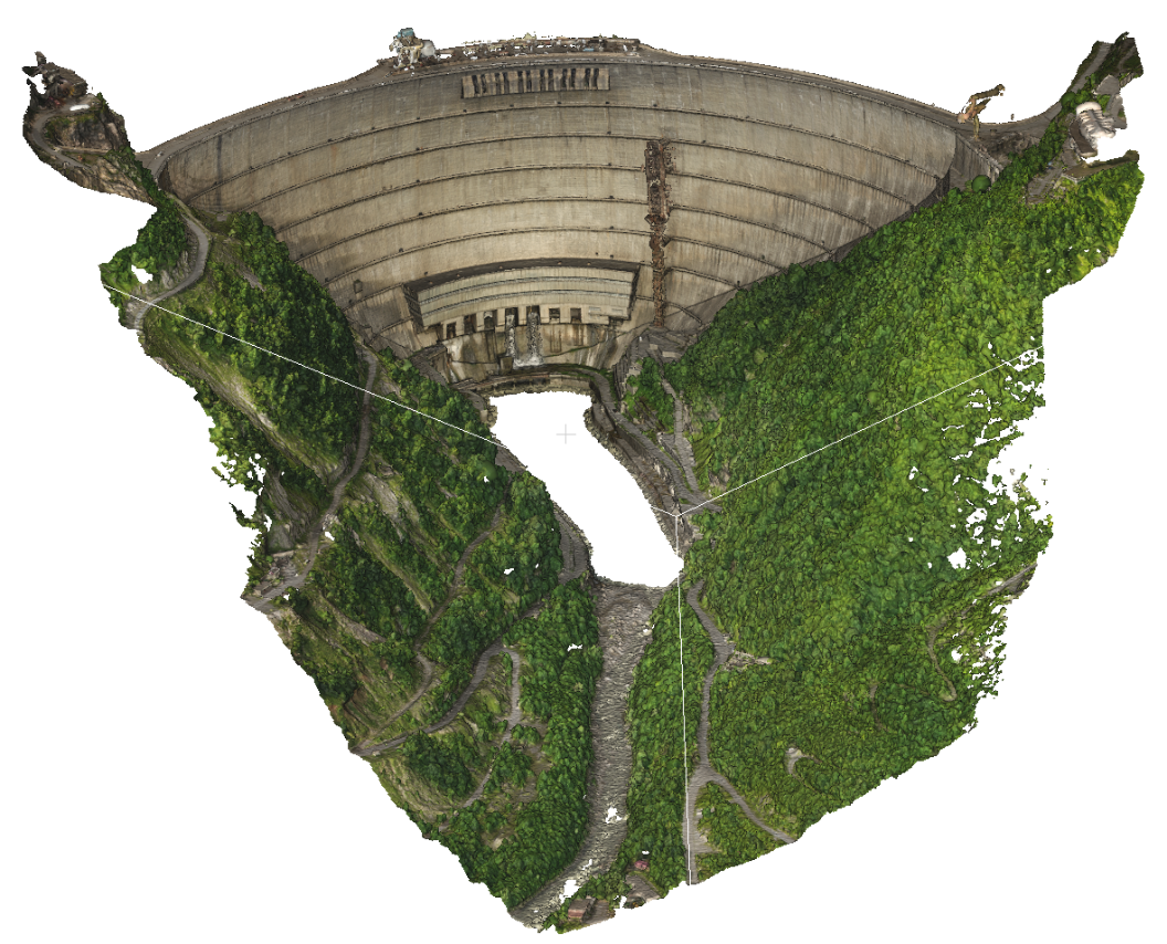
The IPF has also created a 3D model of the dam using photogrammetric data. Air Bavarian realized the flight with a DJI drone equipped with a 20MP camera. We used 7 ground control points measured by GNSS with an accuracy of 2-3 cm to georeference our model.
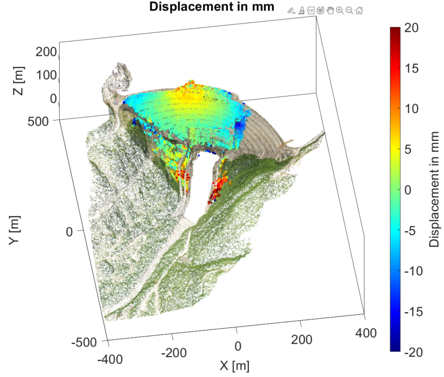
Figure 4 shows a result of the observed displacement between July and September 2022. With the GB-SAR we can cover more than 2/3 of the dam and have an accuracy of the displacement about some millimeters.